Introduction
The past decade has seen a rapid expansion in the production of large-scale geospatial products derived from Earth observation (EO) data using machine learning (ML). A growing range of global products is now routinely generated at resolutions that would have been unthinkable a few years ago, including maps of building footprints [1], land cover [2], canopy height [3], [4], renewable energy installations [5] and flood inundation [6]. This represents a substantial shift from the traditional EO toolkit of spectral indices, radiative transfer (or other physical) models, spectral unmixing, and classical ML pipelines built on hand-crafted features, which historically delivered maps as collections of locally calibrated models tuned to specific regions, sensors, or biomes. ML has shifted this paradigm toward single, globally generalizing models trained on heterogeneous data, promising consistent worldwide products but also introducing challenges with no clear analogue in the traditional workflow. Scaled inference, for instance, now demands engineering skills (distributed compute, efficient I/O, cloud-native data formats) that the traditional EO scientist rarely needed. At the same time, the apparent ease with which such maps seem to be produced hides the depth of the underlying pipeline, and the lowered barrier to entry has enabled a proliferation of map products released without adequate validation.
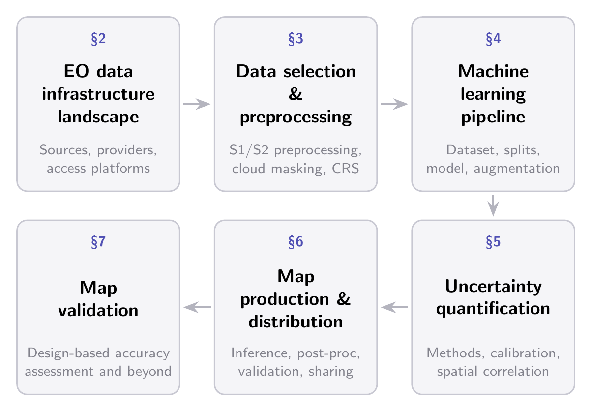
When considering the full workflow for a global map, every stage of the process (from data acquisition and preprocessing, through model design and training, to inference, uncertainty quantification, validation, and dissemination) presents domain-specific challenges that have no direct equivalent in conventional computer vision. These challenges are tightly coupled: preprocessing decisions propagate into the training signal, the training signal shapes the uncertainty landscape, and uncharacterized uncertainty undermines downstream validation and decision-making. This paper is addressed to a broad audience of researchers and practitioners, from those just entering the EO domain to seasoned ML experts looking to build ML-ready EO datasets or generate large-scale maps. It presents an end-to-end account of the best practices, challenges, and common pitfalls that span the entire pipeline from raw satellite data to a published, validated map product. We organize the discussion around six interconnected themes, summarized in Figure 1.1, which trace the pipeline from the EO data landscape and preprocessing, through ML-specific stages of dataset construction, model design, and training, to uncertainty quantification, map generation, dissemination, and validation. Choices made at each stage carry consequences for all subsequent ones, and awareness of these dependencies is one of the factors that separate a technically sound map from a misleading one.